countries. Belarus, Estonia, Finland, Latvia, Lithuania, Moldova, Norway, Russia, Sweden, and Ukraine
year of inscription. 2005
criteria. Cultural
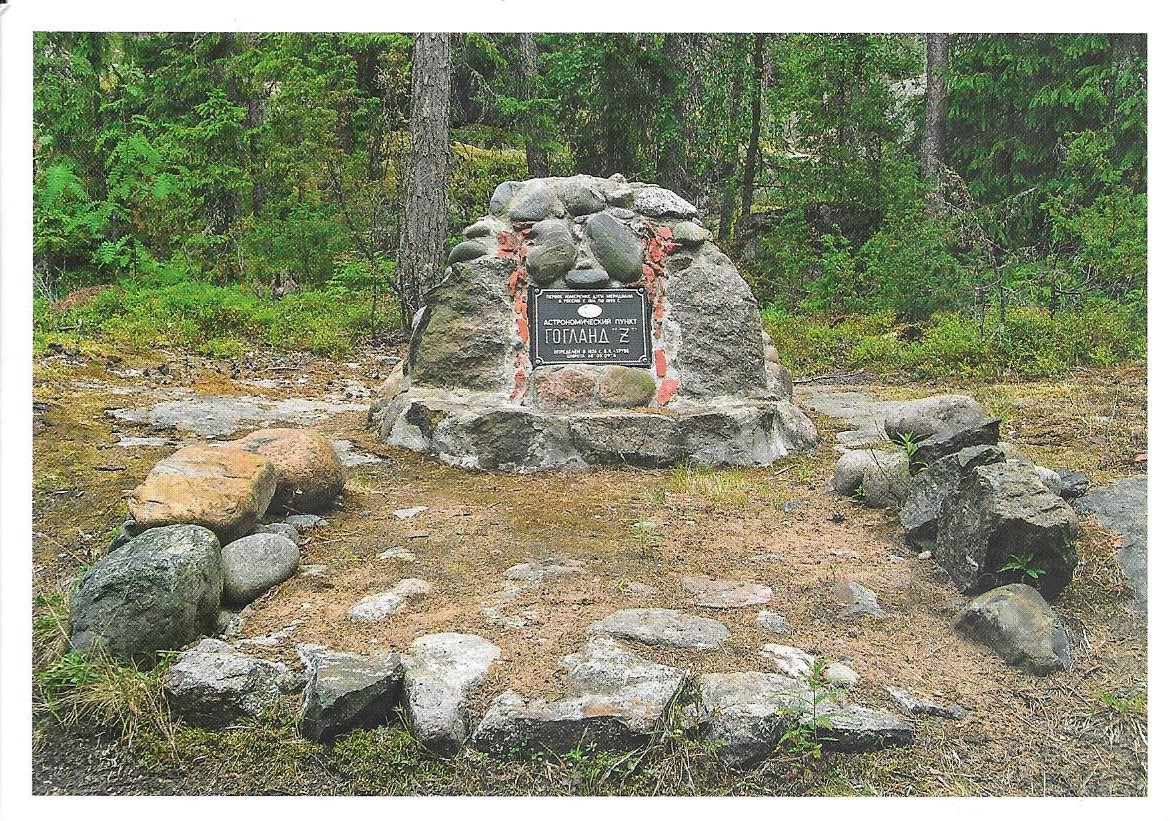
One aspect of academic study that was recorded as far back as the 4th century BCE was establishing the size and shape of Earth. In the 16th century CE, a method known as triangulation was devised to do this. To apply this calculation with greater precision, between 1816CE and 1855CE, astronomer Friedrich Georg Wilhelm Struve established point stations over a long distance. From Hammerfest, Norway along the Arctic Ocean to Staro-Nekrasovka, Ukraine on the Black Sea coast, 265 point stations were established in 10 countries, stretching over 2820km. These stations included a huge variety of forms, including small holes drilled in rocks, some of which were filled with lead; cross-shaped engraved marks on rocks; solid stone or brick with a marker; rock structures (cairns) with a central stone or brick marked by a drilled hole; individual bricks; or specially constructed obelisks or other monuments.
The WHS is composed of 34 of these original point stations in the following locations:
- Norway: four stations in the county of Troms og Finnmark;
- Sweden: four stations in provinces of Lapland and Norrbotten;
- Finland: six stations in the regions of Lapland, Central Finland, Uusimaa, and Kymenlaakso;
- Russia: two stations in Leningrad oblast;
- Latvia: three stations in the municipalities of Ergli, Jekabpils, and Jaunjelgava;
- Lithuania: three stations in the counties of Panevezys and Vilnius;
- Belarus: five stations in the regions of Grodno and Brest;
- Ukraine: four stations in the Khmelnitsky and Odessa oblasts; and
- Moldova: one station in Soroca district.
what. postcard (Russia, 2021)


No comments:
Post a Comment